Nam Ngiep 2A Dam Hydropower info by Hobo Maps - Go to Hydropower Projects Page - - Home
Nam Ngiep 2A Hydropower project is part of Nam Ngiep 2ABC Hydropower project (2A, 2B & 2C) developed by Lao-based Nonghai Group Co. Ltd. in northern Laos southeast of the Plain of Jars area.
Nam Ngiep is pronounced as "Nam Nyiep".
Nam Ngiep 2A project is located near Sai Nam Ngiep, Xieng Khong Village, Thathom District in Xaysomboun Province of Lao PDR.
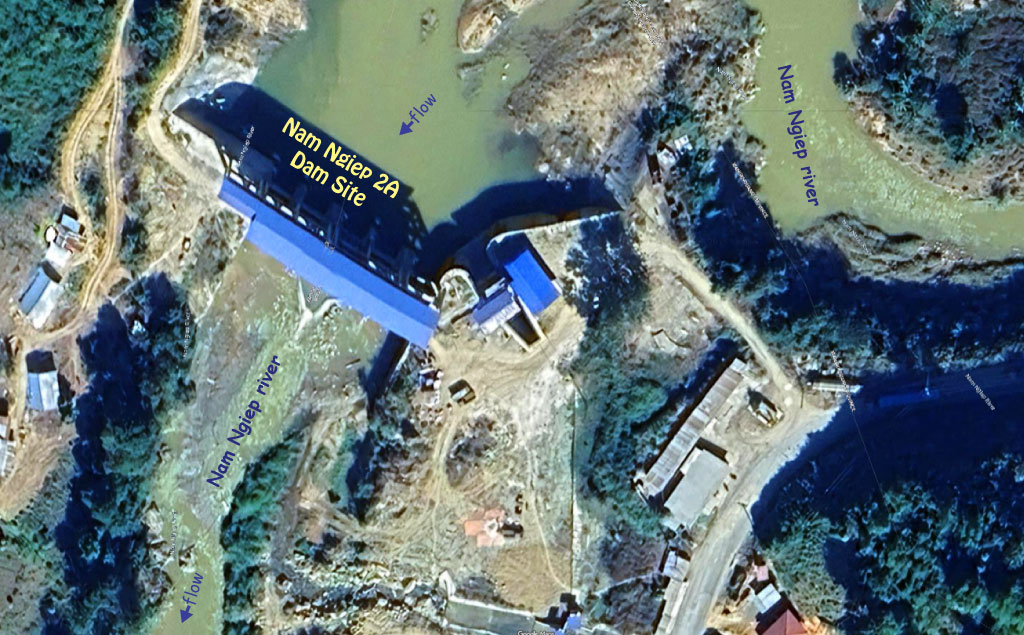
Nam Ngiep 2A dam site is located at coordinates - 19°09'12.7"N 103°20'41.4"E (19.153525, 103.344836) as shown in the satellite image below:
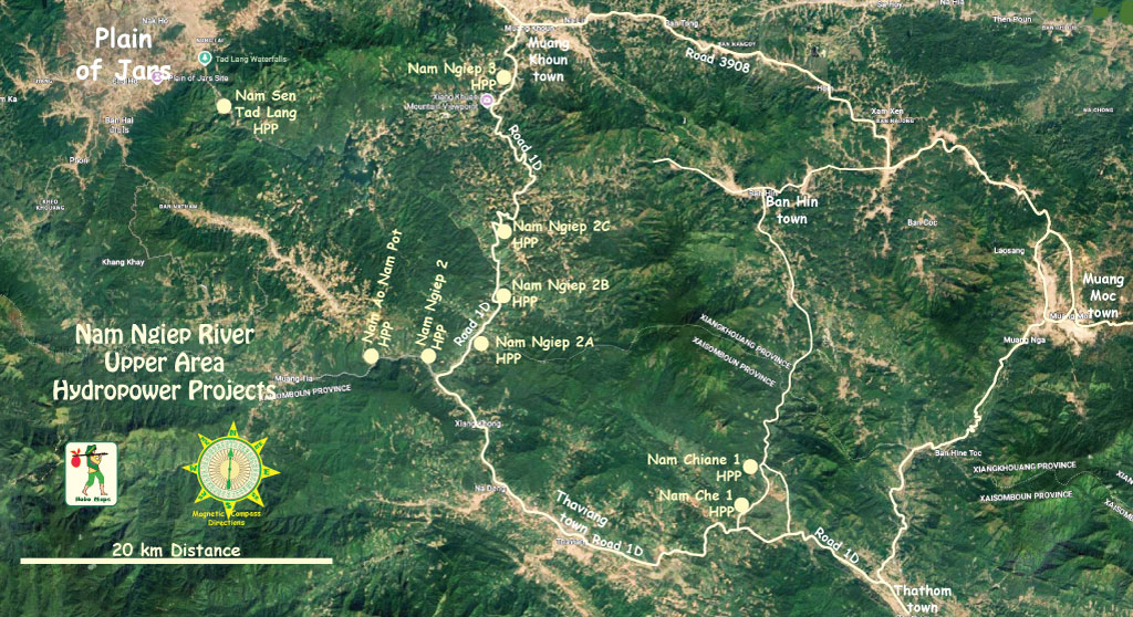
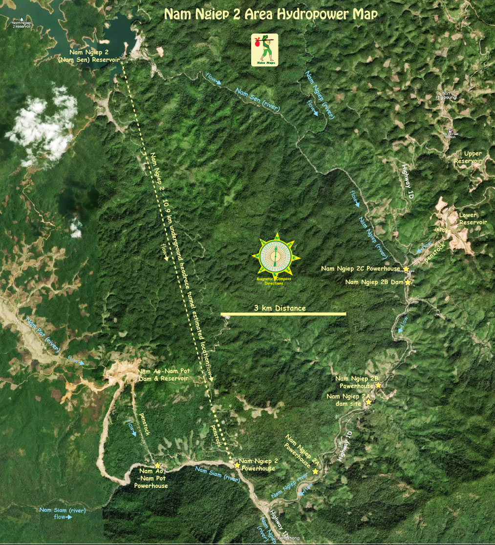
Nam Ngiep 2A HPP location is seen at the mid section of Nam Ngiep upper area map below:
The engineering, procurement and construction (EPC) contractor for the project was Chongqing Water Turbine Works Co., Ltd (CWTW) from China.
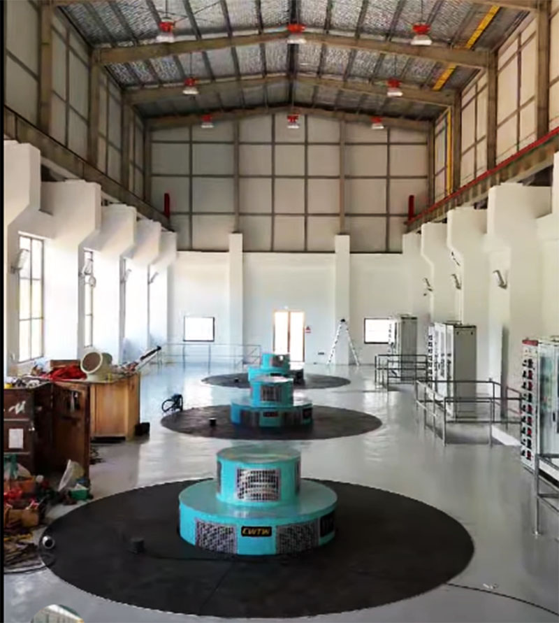
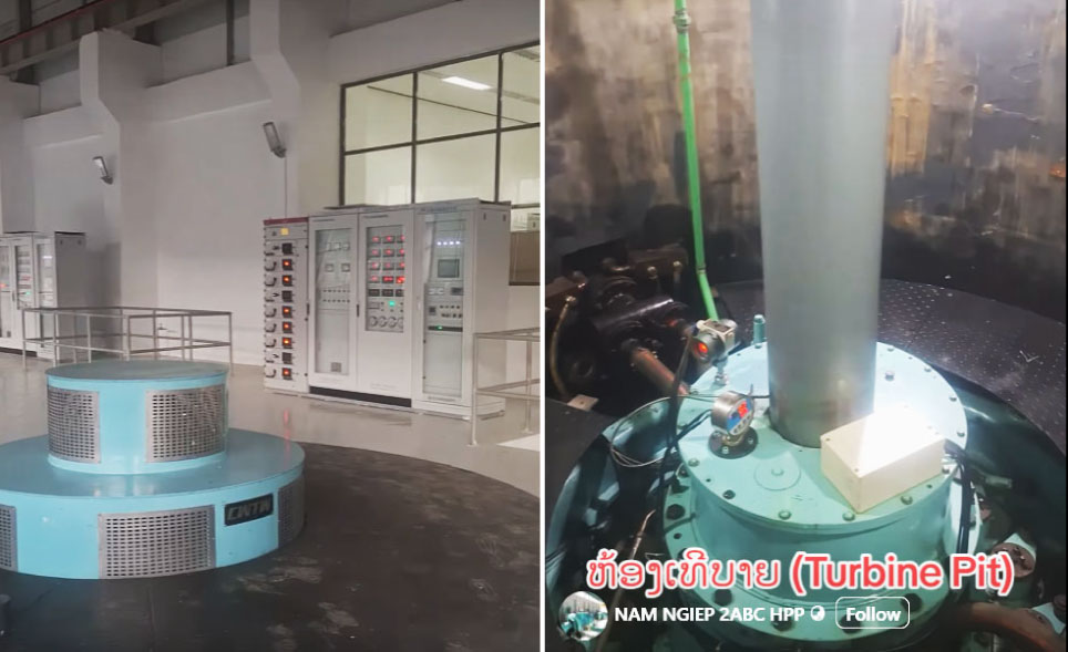
The project installed capacity is 10.5 MW from 3 Vertical Francis turbine-generator sets of 3.5 MW each with annual output potential of 52 GWh.
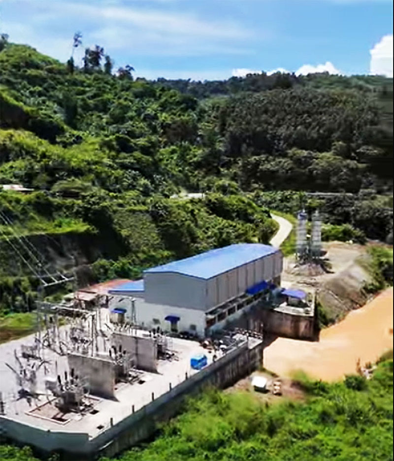
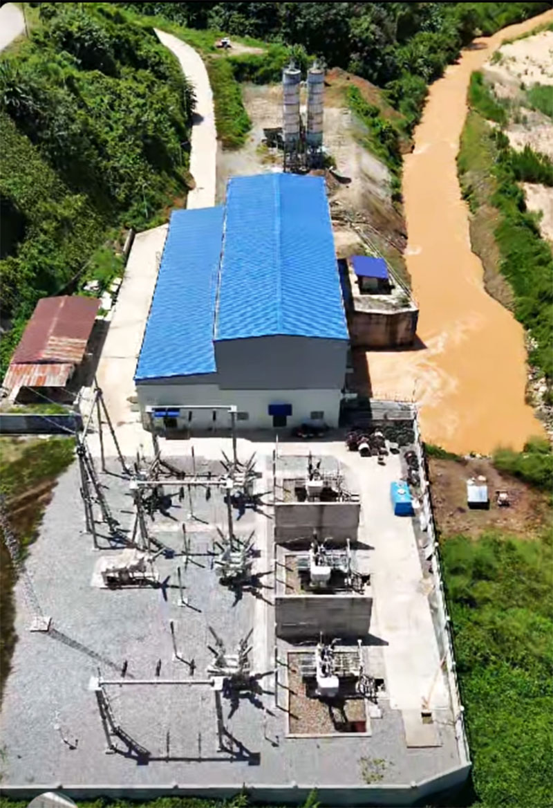
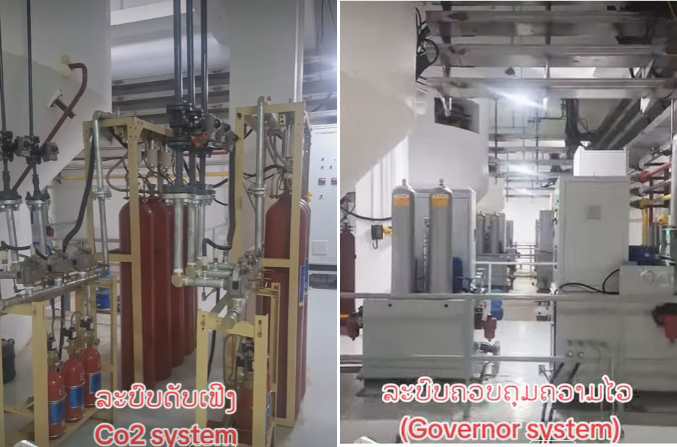
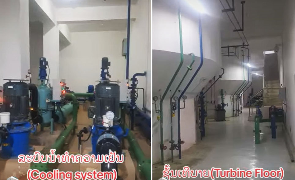
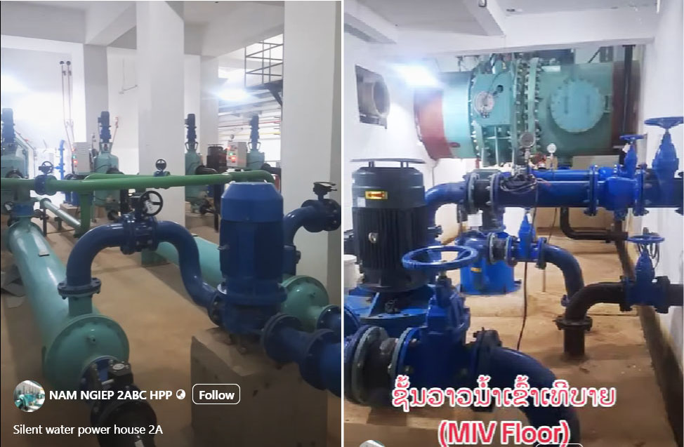
From images we see below here it seems that Nam Ngiep 2A HPP is fully complete and operating in 2026 but we don't have verification of that yet or any info about who may be offtaking the output or where the output is going. Also need info about who the official owner is.
Nam Ngiep 2A powerhouse images below at coordinates - 19°08'05.9"N 103°19'59.9"E (19.134972, 103.333306):
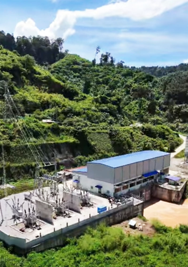
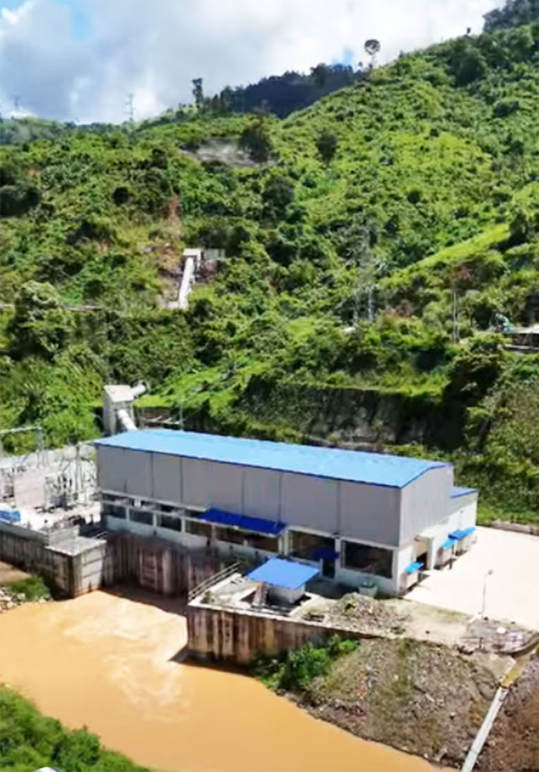
Nam Ngiep 2A powerhouse interior image below:
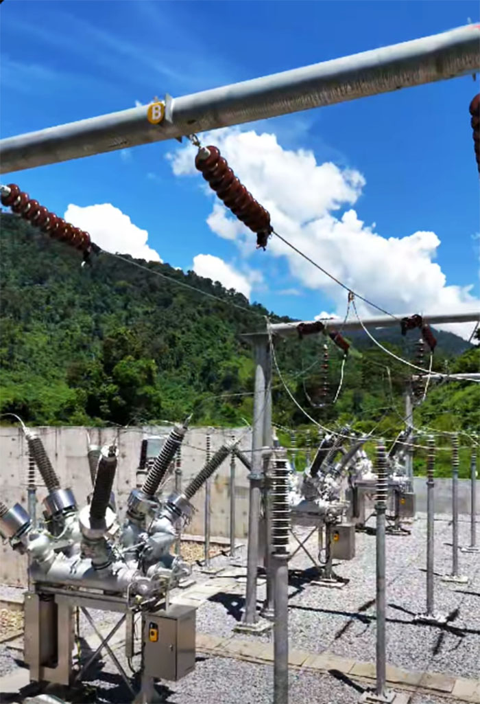
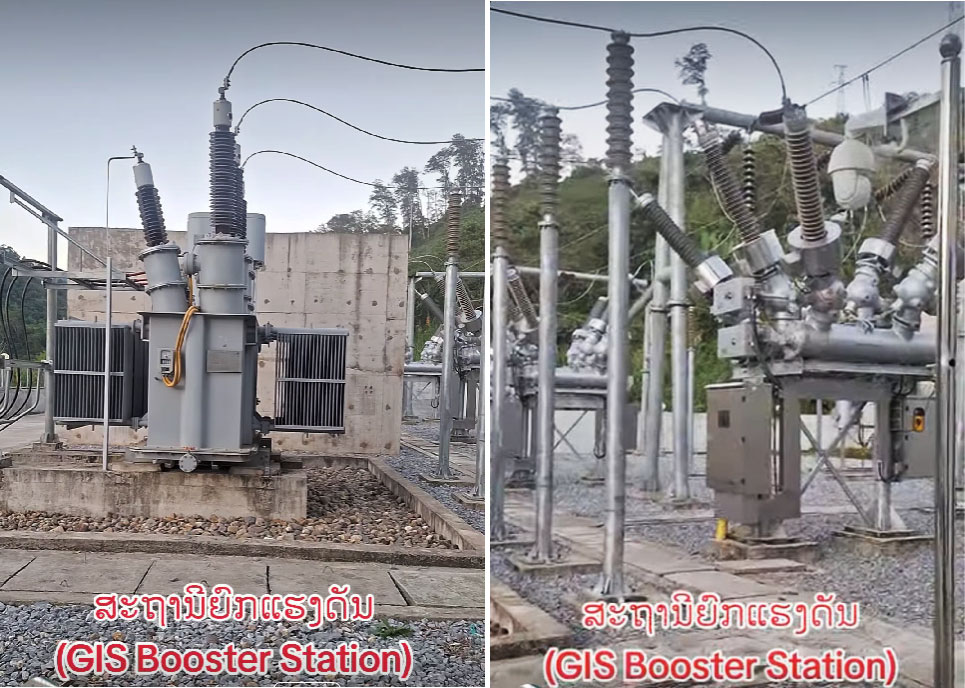
Nam Ngiep 2A switchyard image below:
The dam is constructed of reinforced concrete with a drainage gate.
The project water catchment area is 878 square kilometers.
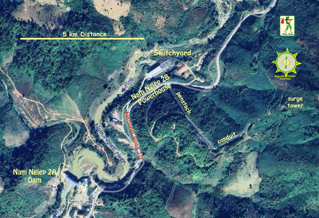
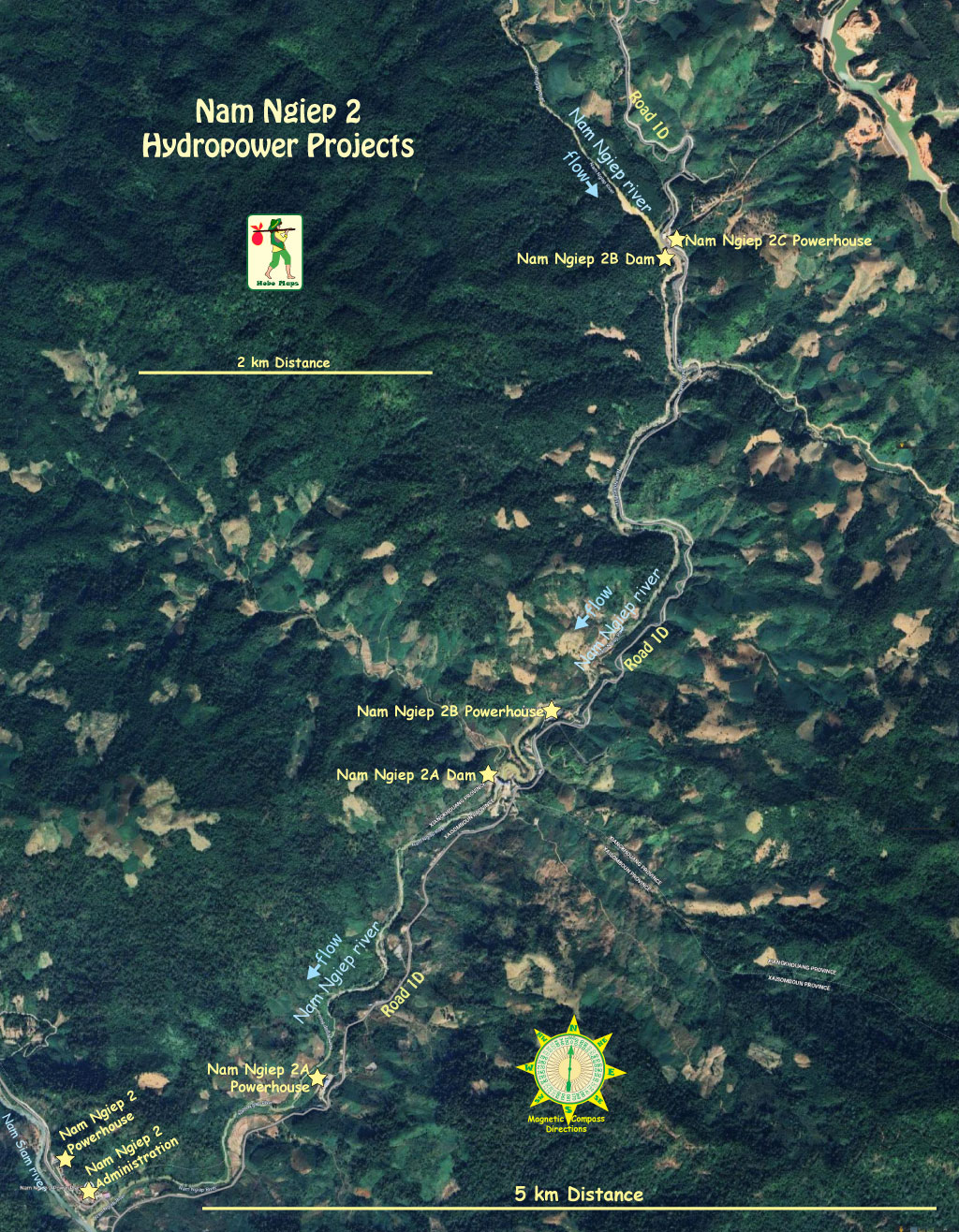
Nam Ngiep 2A dam site is slightly downriver and close to Nam Ngiep 2B hydropower project site - both are seen in satellite image below:
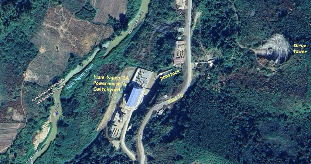
Nam Ngiep 2A powerhouse site image below:
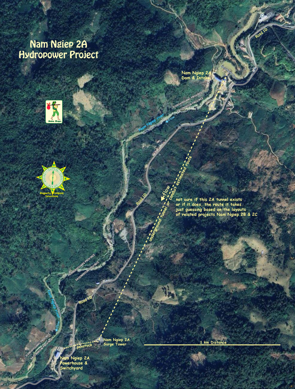
Nam Ngiep 2A layout image below shows estimated unverified underground conduit.
Images below courtesy of Thep Malaykham from his Facebook posting on Lao Hydropower 22 November 2025.
Map below shows location for Nam Ngiep 2A hydropower project.
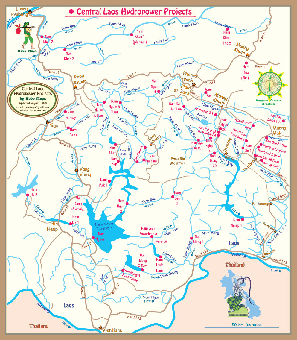
Click to see our other web pages for Nam Ngiep 2B and Nam Ngiep 2C.
Satellite image map below for Nam Ngiep 2A, 2B & 2C hydropower projects:
Satellite image map below for Nam Ngiep River Basin hydropower projects:
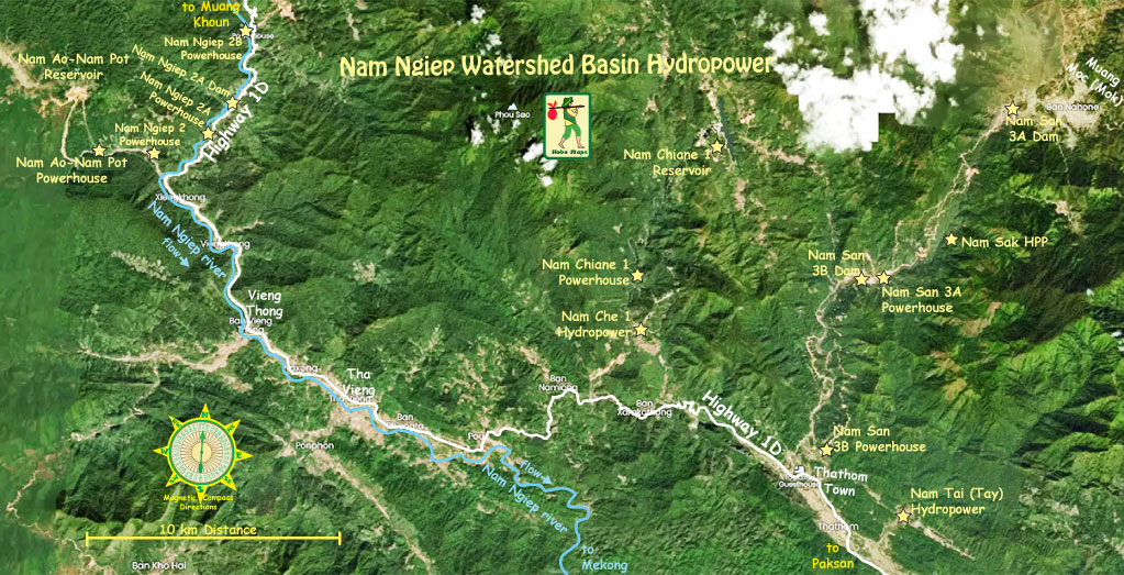
Click HERE to see our hydropower web page for the greater Nam Ngiep catchment basin which describes the various dams, reservoirs and diversion projects in the drainage basin that are often inter-connected.