Nam Tay (Tai) Dam Hydropower Info by Hobo Maps - Go to Hydropower Projects Page - - Home
The Nam Tay (Tai) river is a small tributary of the Nam Ngiep (river) in northern Lao PDR. The Nam Ngiep flows southeast and eventually merges with the Mekong River near Paksan.
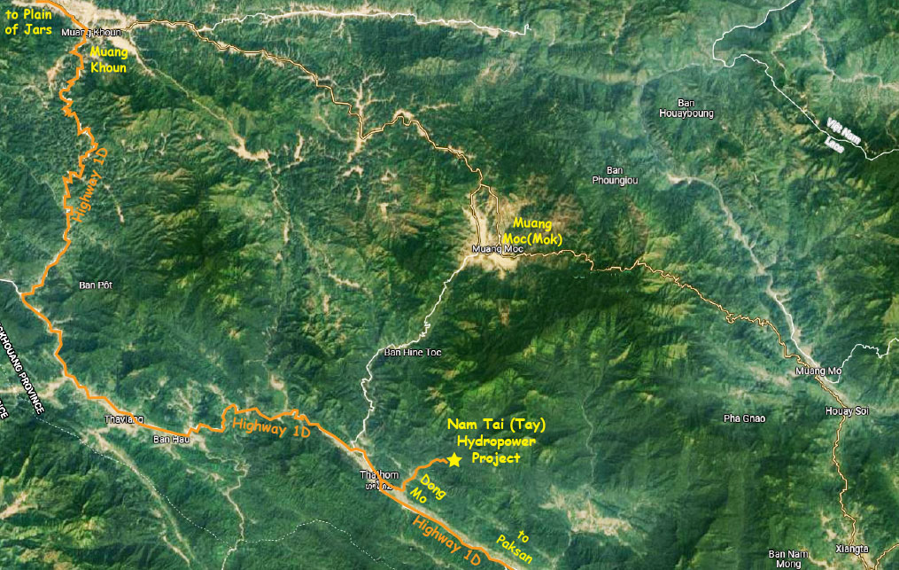
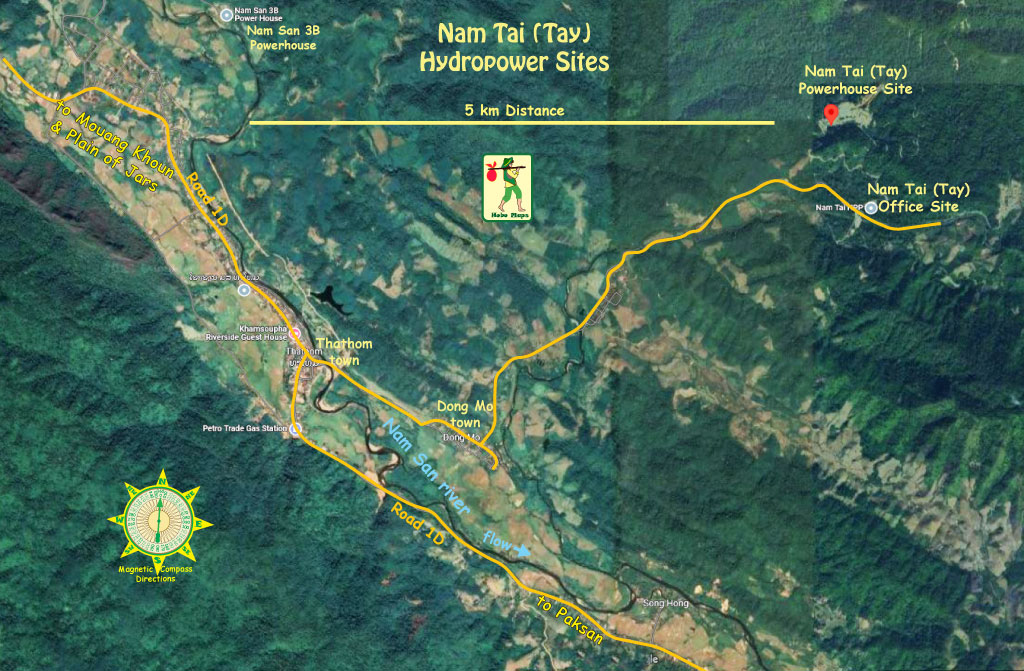
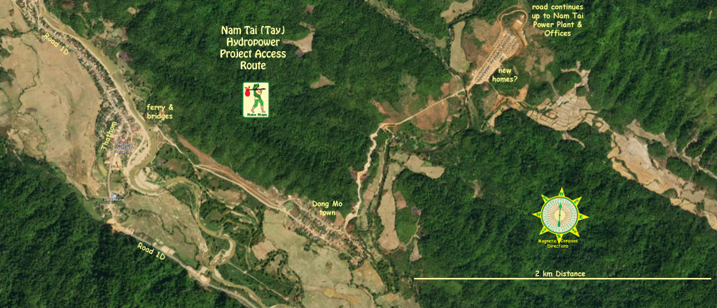
The Nam Tay (Tai) Hydropower project site is near Nahinboun village in Thathom District of Xaysomboun Province. There are two sites about 6 km north of Dong Mo village which is not far off of Highway 1D about 2 km east of Thathom town.
Very little info is known about this project and in 2026 we are still unsure of where the water source is and if there may be a reservoir further north of the powerhouse. Newer satellite images are needed.
The satellite images below show Nam Tai (Tay) Hydropower project locations.
The Nam Tay (Tai) Hydropower project was originally developed by Nam Tai Power Sole Co. Ltd, a direct subsidiary of Lao-based Phongsupthavy Group with intent for export of the output to Vietnam.
Phongsupthavy Group is active in other hydropower projects in northern Laos and in 2020 and 2021 entered into various Memorandums of Understandings (MOUs) with Electricity of Vietnam (EVN) for offtake of output from Nam Tay and other projects.
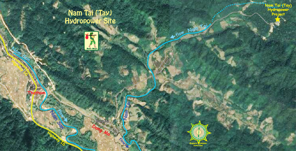
Satellite image below shows Nam Tai (Tay) Hydropower project site location:
In late December 2021 it was announced that Thai-based BCPG Indochina Co. (BIC) had purchased 25% of the ordinary shares of the project owner Nam Tai Power Sole Company Limited in the approximate amount of US$ 32 million. This same purchase also involved a transfer of ownership interest in a new 220 kV transmission line to Vietnam which gives BCPG Indochina Co. the right to transmit electric energy output from its Lao hydropower plants to Vietnam for sale to Electricity of Vietnam (EVN). BCPG Indochina Co. also owns two other hydropower projects in the same area as Nam Tay (Tai) Hydropower - Nam San 3A & Nam San 3B.
Nam Tai power plant site image below at coordinates - 19°00'23.5"N 103°39'18.2"E (19.006540, 103.655060):
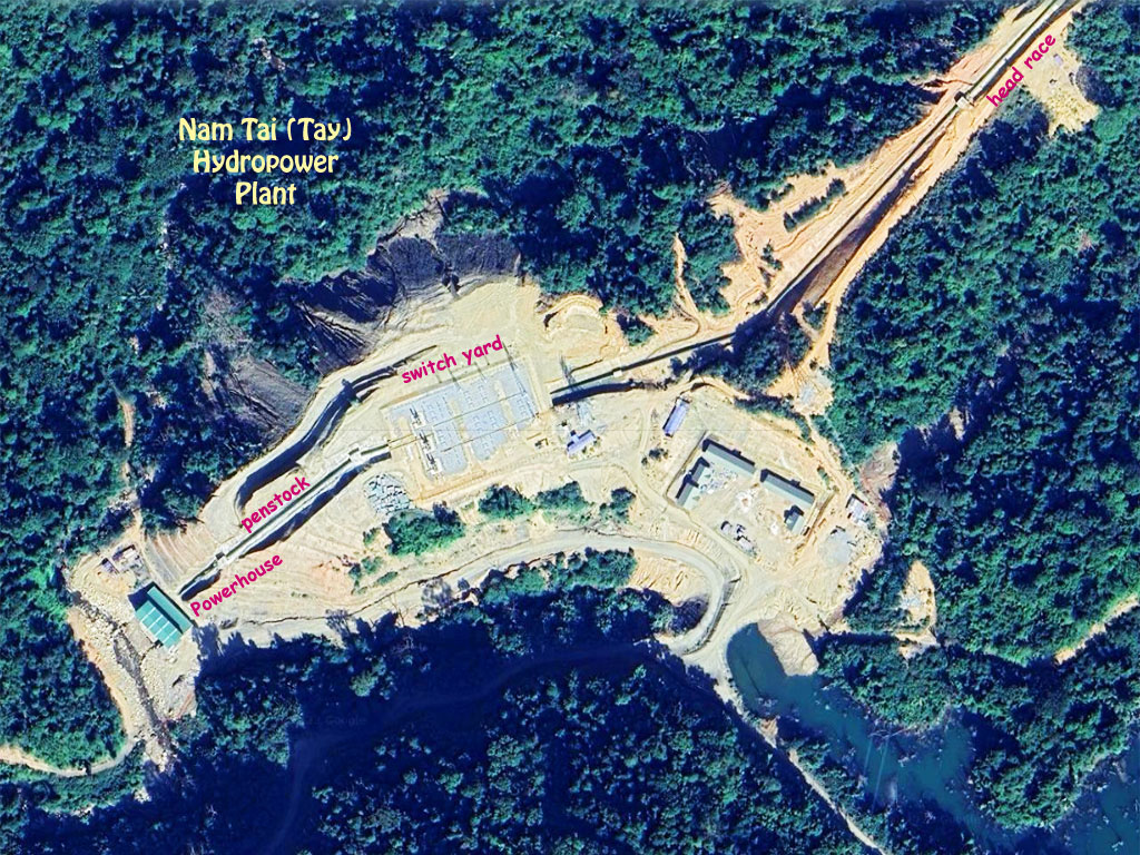
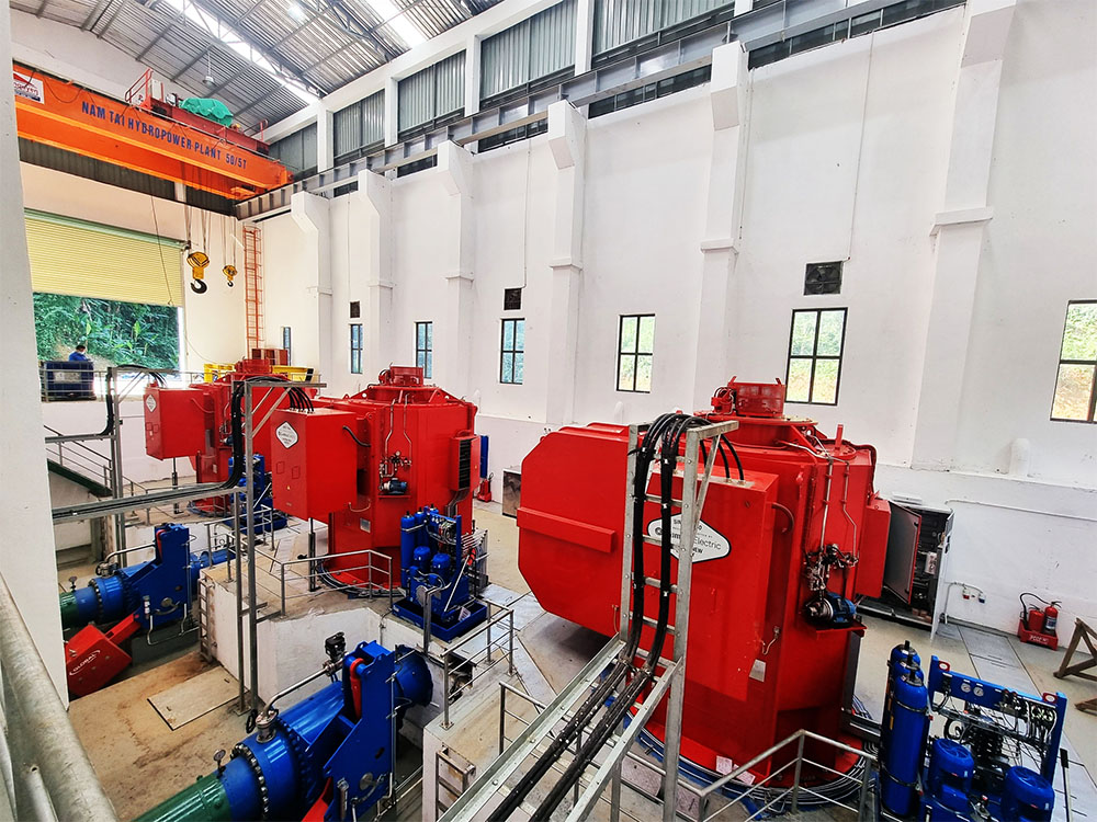
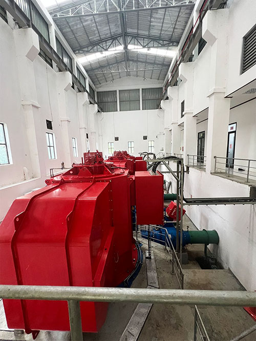
The Nam Tay (Tai) Hydropower plant will have three turbine generator sets of 9 MW each for total capacity of 27 MW (or maybe 25.5) and estimated annual output ability of 101 GWh.
In Dec. 2020 a 6 MW addition was approved along with an additional investment of $ 2,575,000 USD for the expansion which would bring total capacity to 33 MW (or maybe 31.5) when completed.
The project in 2026 is completed and probably exporting its output to Vietnam. A Power Purchase Agreement with EVN was signed on June 28, 2021 for sale and export of output from Nam Tay to Vietnam.
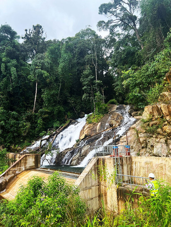
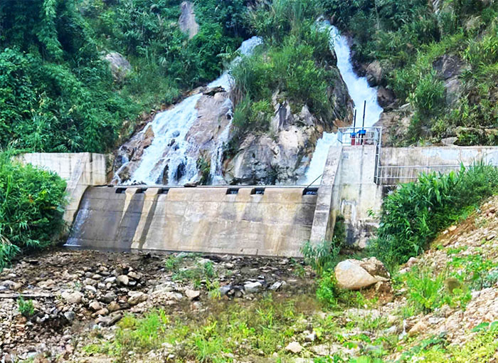
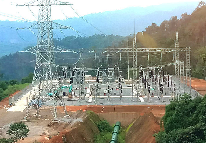
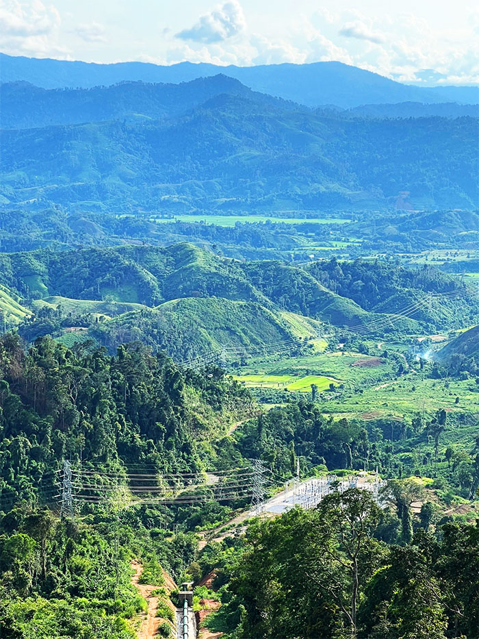
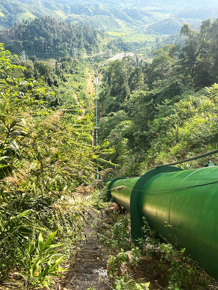
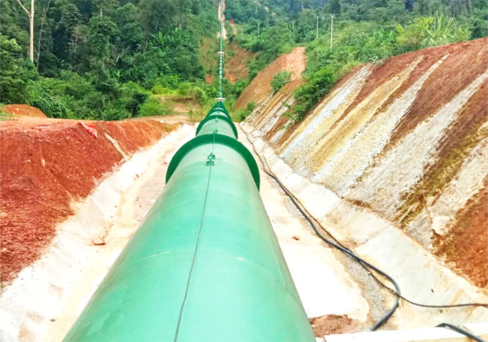
Nam Tai project images below:
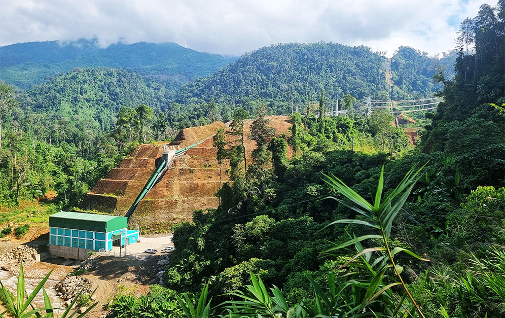
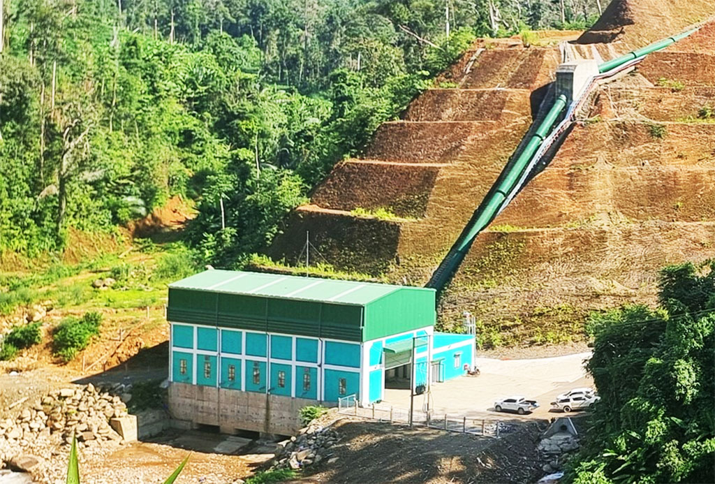
The weir & waterfall pond images below may be the source of water flowing into the penstock eventually but we have no info about the conduits or channels above the penstock or even whether there may be a larger dam and reservoir as part of the system.
Nam Tai controls images below:
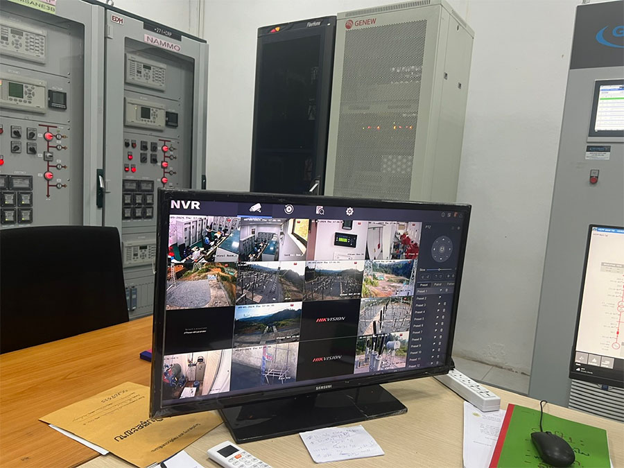

On May 8, 2024, EDL-Gen Operation and Maintenance Service Sole Co., Ltd (EDL-GEN O&M) and Nam Tai Hydro Power Co., Ltd. signed an Operation and Maintenance (O&M) contract agreement for Nam Tai Hydroelectric Power Plant. This O&M contract is effective for a term of 25 years from June 1, 2024 to May 31, 2049.
Nam Tai generator images below:
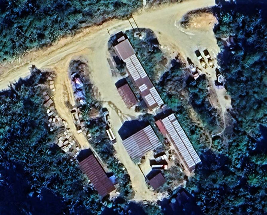
Nam Tai HPP administration site image below at coordinates 18°59'57.5"N 103°39'29.2"E (18.999300, 103.658100):
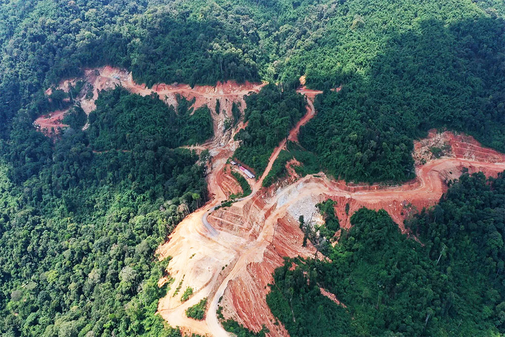
Nam Tay sitework 2020 image below:
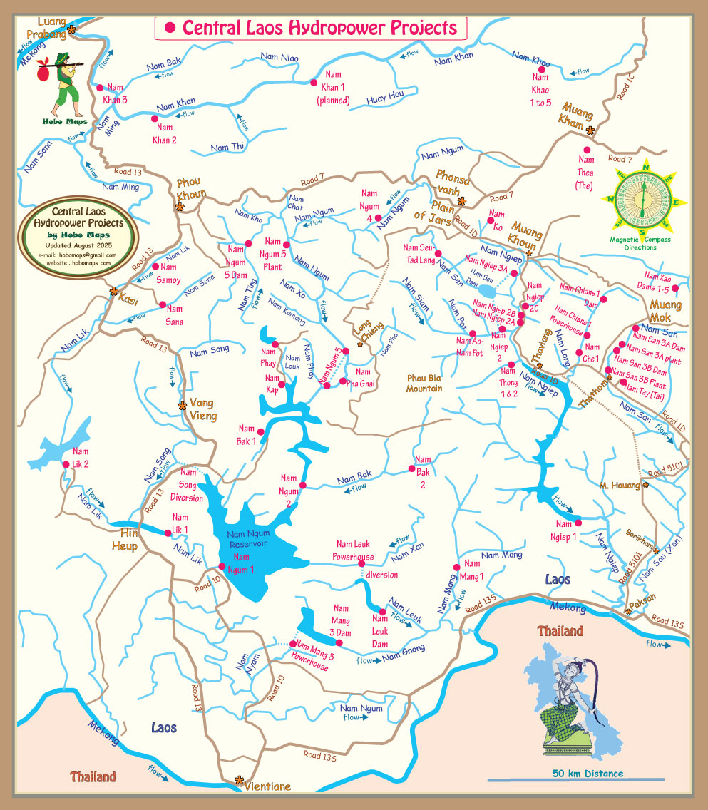
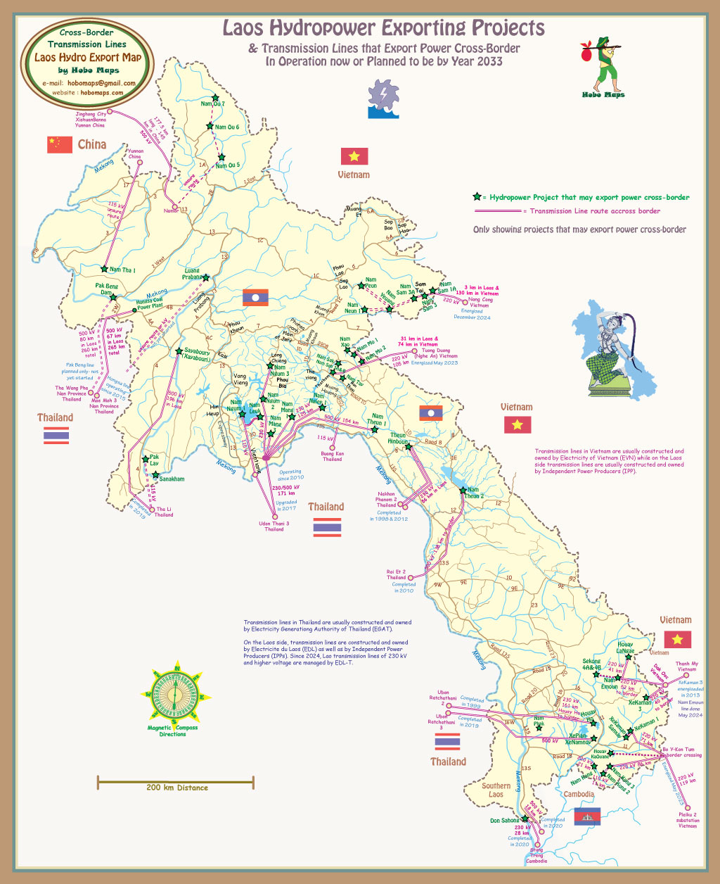
Nam Tay Hydropower shown at right side of map below:
Nam Tay (Tai) hydropower project is one of 11 hydropower plants being developed by Phongsupthavy Group for sale of electricity to Vietnam through a 79 km 220 kV transmission line called Nam Mo - Tuong Duong (Nghe An). This line is invested by Phongsupthavy Group for the section in Laos and by Electricity of Viet Nam (EVN) for the section in Vietnam. The transmission line was completed and energized in May 2023 and synchronized with the Vietnamese grid.
The chart below shows about 100 km distance of transmission line from Nam Mo 2 station to Tuong Duong station in Vietnam.
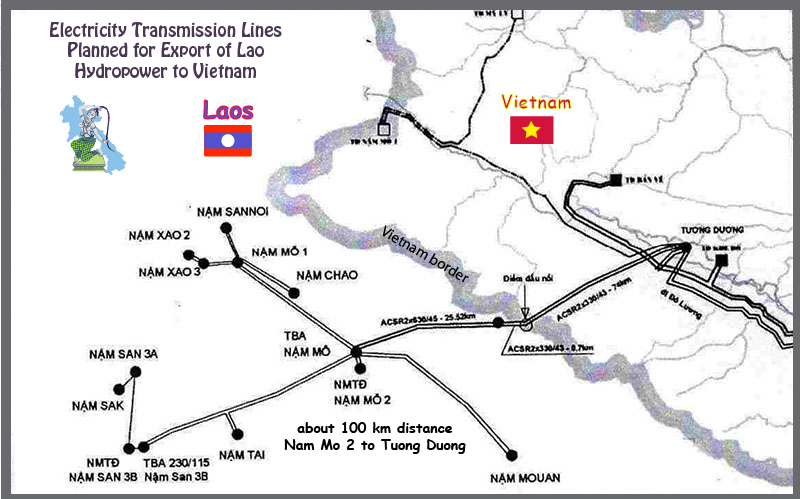
Map below has old info from early long-term planning.
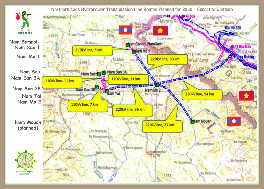
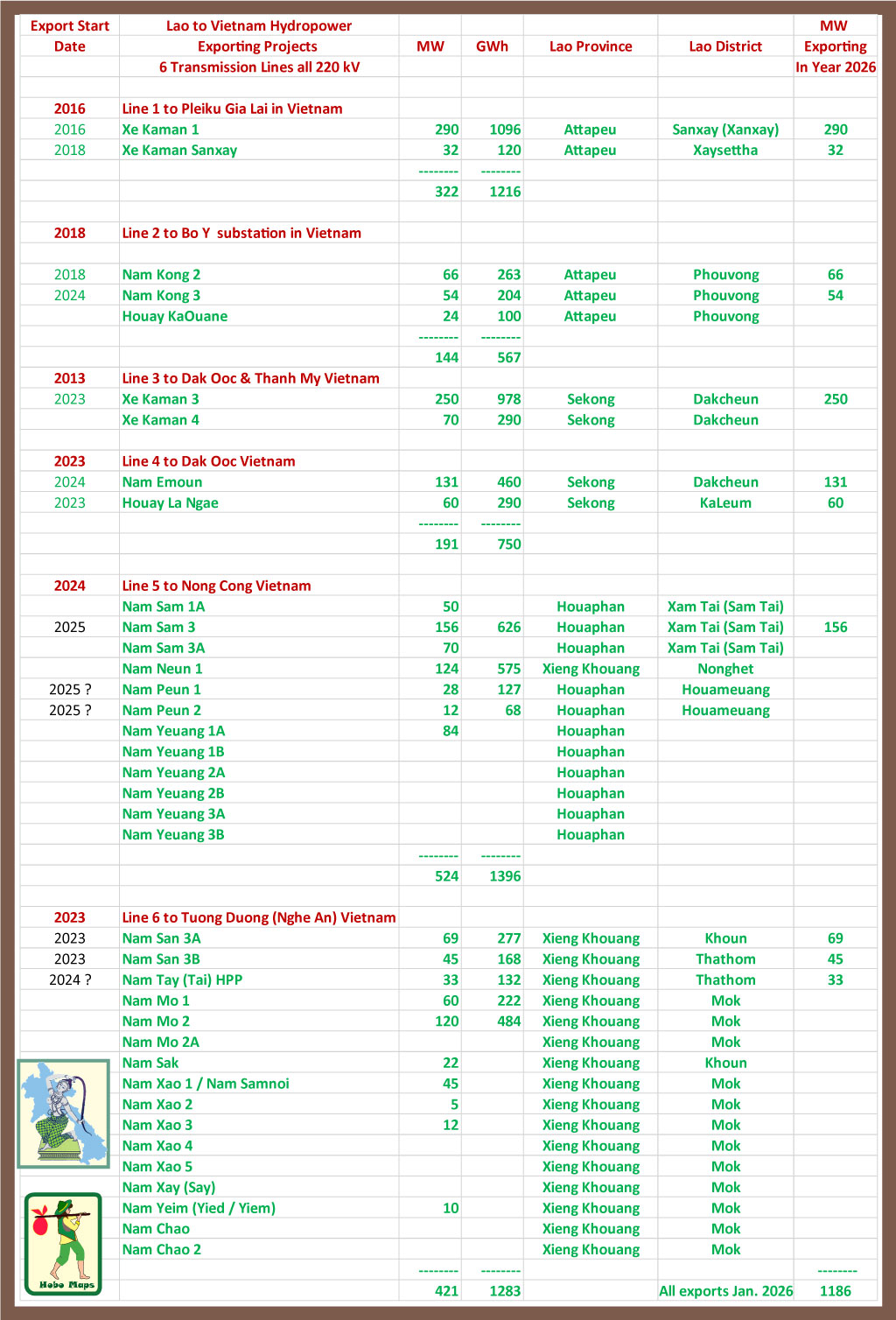
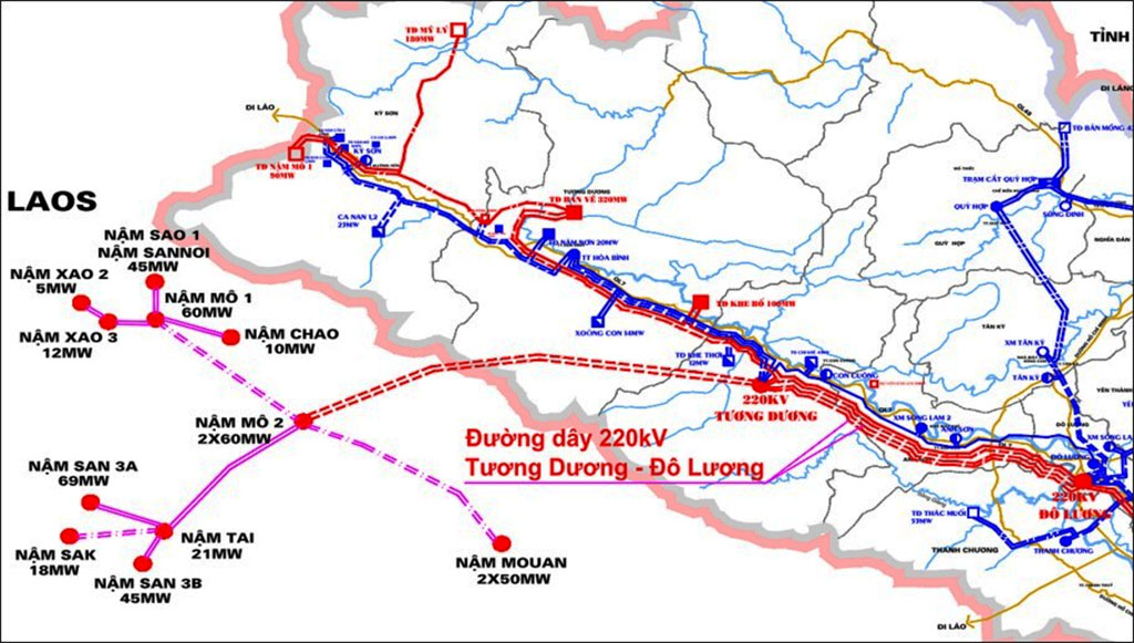
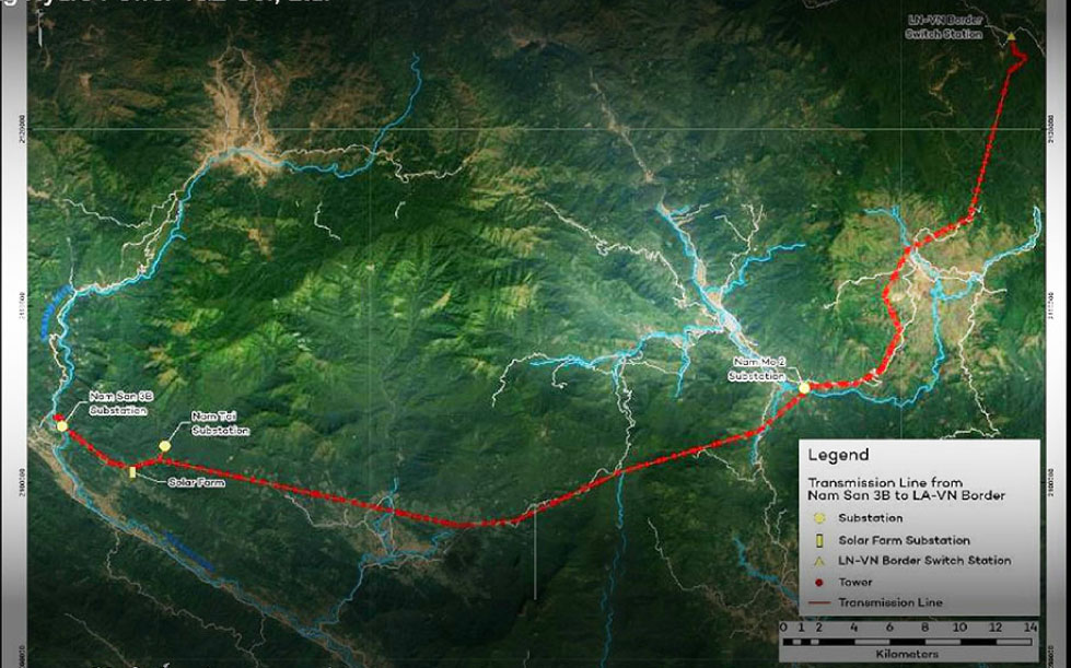
Nam San 3B substation transmission line in map below includes output from Nam Tay for export to Vietnam.
See enlarged version of below map HERE.
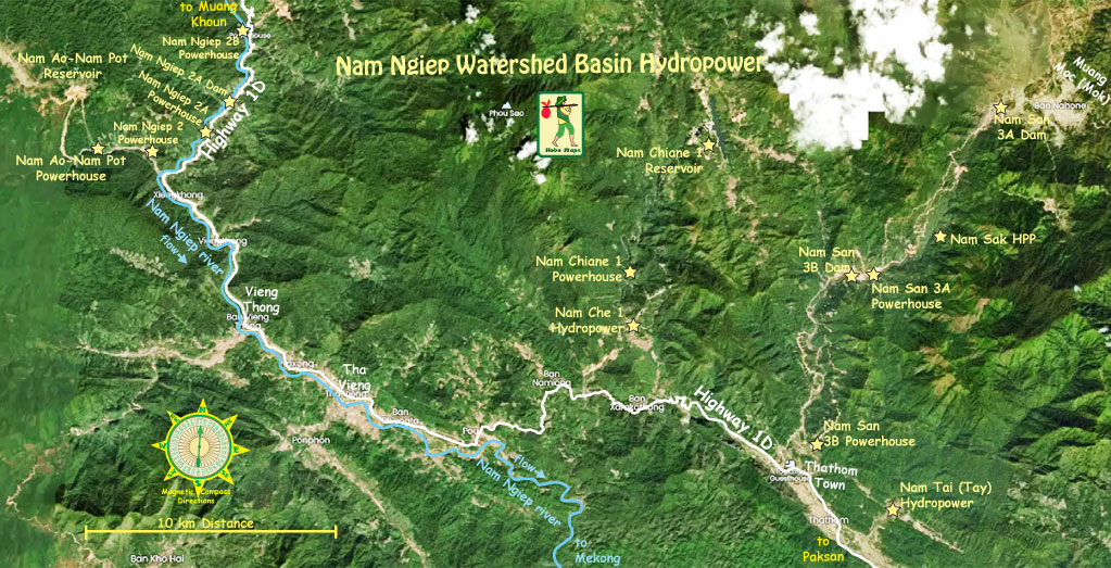
Satellite image map below for Nam Ngiep River Basin hydropower projects: